Showing posts with label mount. Show all posts

Saturday, June 13, 2015

Bromo -- Jember -- Banyuwangi -- Gilimanuk -- Ijen Day 5 - 2015 June 13 > East Java ~ Indonesia

We woke up early, then depart from Jember at 02:30 in the morning. It took almost 3 hours to go to Ijen Crater. Ijen crater located in the middle of Jember and Banyuwangi, but Banyuwangi is nearer than Jember. So it's better if you stay at Banyuwangi.

Credit: Wikipedia

The Ijen volcano complex is a group of stratovolcanoes in the Banyuwangi Regency of East Java, Indonesia. It is inside a larger caldera Ijen, which is about 20 kilometers wide. The Gunung Merapi stratovolcano is the highest point of that complex. The name "Gunung Merapi" means "mountain of fire" in the Indonesian language (api being "fire"); Mount Merapi in central Java and Marapi in Sumatra have the same etymology.

West of Gunung Merapi is the Ijen volcano, which has a one-kilometer-wide turquoise-colored acidic crater lake. The lake is the site of a labor-intensive sulfur mining operation, in which sulfur-laden baskets are carried by hand from the crater floor. The work is paid well considering the cost of living in the area, but is very onerous. Workers earn around Rp 50,000 - 75,000 ($5.50-$8.30) per day and once out of the crater, still need to carry their loads of sulfur chunks about three kilometers to the nearby Paltuding Valley to get paid.

Many other post-caldera cones and craters are located within the caldera or along its rim. The largest concentration of post-caldera cones run east-west across the southern side of the caldera. The active crater at Kawah Ijen has a diameter of 722 metres (2,369 ft) and a surface area of 0.41 square kilometres (0.16 sq mi). It is 200 metres (660 ft) deep and has a volume of 36 cubic hectometres (29,000 acre·ft).

The lake is recognised as the largest highly acidic crater lake in the world. It is also a source for the river Banyupahit, resulting in highly acidic and metal-enriched river water which has a significant detrimental effect on the downstream river ecosystem. In 2008, explorer George Kourounis took a small rubber boat out onto the acid lake to measure its acidity. The pH of the water in the crater was measured to be 0.5 due to sulfuric acid.

The path to the peak

view while hiking
view while hiking 
After a while, we arrive at Pondok Bunder Kawah Idjen. This is the first post, so you can rest in here.


After rest for a while, then we continue to hike.

The path is getting slipier
view while Hiking


We are getting near the peak

Almost arrive at the peak
After a while, finally we arrive at the peak. From far away, you can see a beautiful scene.

Ijen Crater

Ijen Crater


Sulfur Worker, they climb and go down twice a day
when it's dark, on the spot that release the smoke, there's blue fire


We can't go down there because it's dangerous

Enjoy the scene...
 After a while, the sun is getting hot. And it's almost 10 a.m. So we decided to go down.


When we go down, it's more slippery than when we go up. So, you have to becareful. And it's more tiring because we need to break our foot, and it hurts the knee. But it's faster than when you go up. We only took 1 hour to go down.

The Ijen Crater Basecamp


Sulfur Stone


Today's journey only go to Ijen Crater, because it took a lot of time and energy. So, we go back to Jember to rest.

Thursday, October 16, 2014

Seoraksan National Park > Sokcho ~ South Korea > Day 09 (3) - 2014 October 16 (Busan, Gyeongju, Seoul, Daegwallyeong, Nami Island, Mt Seorak, Kuala Lumpur)

We still have time, so I decided to separate from my friend. She said that she wants to sit beside the river and enjoy the scene. So I decided to walk in the front of Cable Car's building. There's direction to where is it go.


I decided to visit the Temple because it's the nearest.

The gate to the Temple
It's a big Budha statue. Many people come here to pray.


After taking photos, I decided to go back to Cable Car's Building, and while waiting for the time, I bought hot chocolate. I'ts already cold in autumn even the sun shine brightly.

At 15:30, I go to level 2 and wait my boarding in there.

Seoraksan National Park > Sokcho ~ South Korea > Day 09 (2) - 2014 October 16 (Busan, Gyeongju, Seoul, Daegwallyeong, Nami Island, Mt Seorak, Kuala Lumpur)

Seoraksan Bus Station is the last station. So you won't missed it. It's so crowded with tourists. The bus station and the entrance is quiet far. So you have to walk 10-15 minutes to the entrance. Just follow the others, because most of them is go to Seoraksan National Park.


The entrance ticket cost KRW 3.500/pax. Once we entered, we could see the beautiful autumn.


Seoraksan, also referred to as Seolsan and Seolbongsan, the mountain was named Seorak ('Seol' meaning 'snow' and 'Ak' meaning 'big mountain') because the snow would not melt for a long time keeping the rocks in a permanent state of white. In November 1965, the Seorak Mountain district was designated as a Natural Monument preservation area. Afterwards in December 1973, it was designated as a park preservation area, and in August 1982, as a Biosphere Preservation District by UNESCO.

The park is spread across 4 cities and counties: Sokcho, Inje, Goseong and Yangyang. The highest peak is Daecheongbong; to the east is OeSeorak and to the west is NaeSeorak, which is divided again into North NaeSeorak and South NaeSeorak. North NaeSeorak is composed of Bukcheon, which flows to Ingyecheon and Baekdamcheon streams. There are numerous valleys in NaeSeorak. Follow the Baekdamcheon valley where all the streams meet and you will reach Baekdamsa Temple, which is known for its beautiful scenery. Upstream there is Gayadong valley and Suryeomdong valley, and past Yeongsiam and Mangyeongdae there is Madeungryeong ridge (1,327m) that leads to Seorakdong.

Follow Suryeomdong valley and you will reach Waryong and Ssangpok waterfalls. Further up is Bongjeongam (1,224m sea level). Once you arrive at Daecheong peak you can view the magnificent mountain range. The sunrise viewed from here is spectacular and should not be missed. South NaeSeorak directs the valley from Oknyeotang area to Hangyeryeong. Daeseung Waterfall north of Jangsudae is the most beautiful site of NaeSeorak, which is 88m high. South of Yongdaeri valley is the twelve fairy bathing spring, Oktang Falls, and Yongtang Falls, along with several other traditional relics.

Credit: VisitKorea

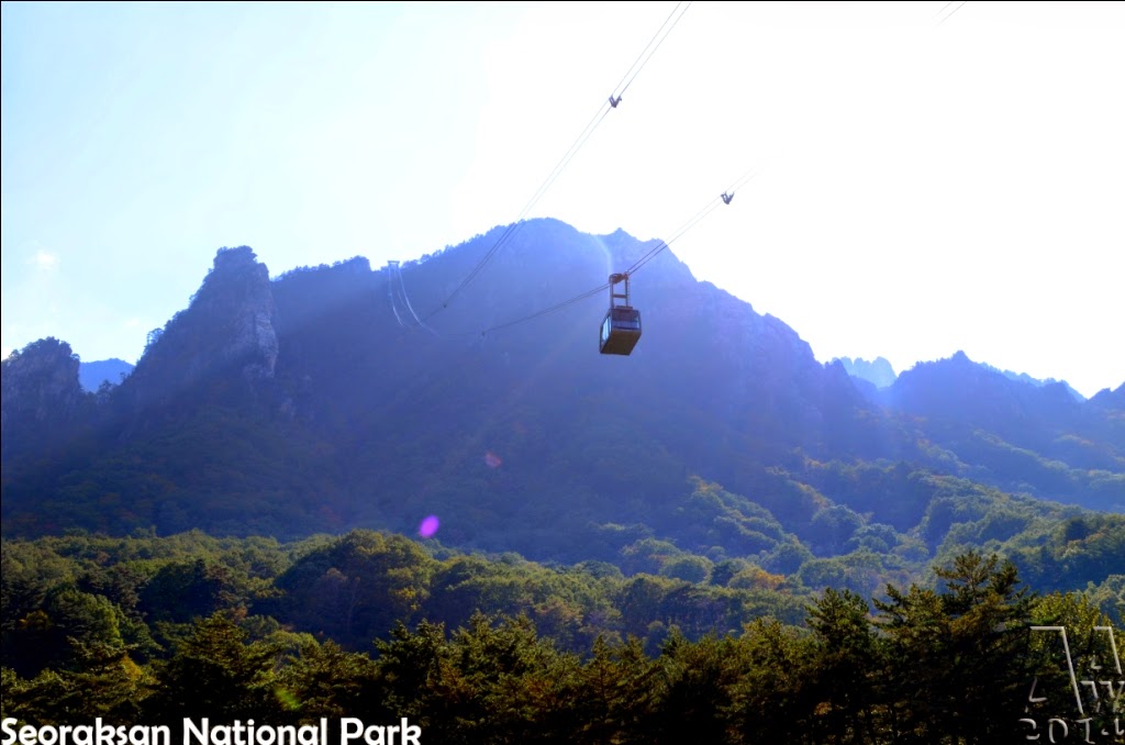
We bought the cable car ticket first. And we have to queue. There's the time schedule in there, which show what time the next cable car.

I got 15:45 cable car.


The cable car cost KRW 9.000/pax. We wait for approximately 2 hours. While waiting, we walk around the cable car area. In the behind cable car's building, there's a river with amazing scene. There's also a bridge to some attraction place (I didn't remember).

behind the cable car's building

the river


the bridge


If you want to explore more, stay for 1 / 2 nights in here. I see that there's a cabin inside the Seoraksan National Park. You can try to sleep in there, so if you want to watch sunrise, you could ride the cable car early.


Wednesday, April 16, 2014

Hash :: Pogalan > Magelang ~ Central Java ~ Indonesia

As usual, it's Wednesday, time for jogging. Today's route was at Pogalan, near Mount Merapi.

The track was nice, and the scene was beautiful. But it's too far away. We cross another district, which make us have to rent a car to go back to the runsite.


As you can see, the dot mark is when I rode the car. 


We can see 4 mountains while we walk. Mount Merapi, Mount Sumbing, Mount Merbabu, and Mount Sindoro. 

Someone said, that this is Hill at Tempuran

Mount Sumbing

Mount Merapi

Mount Sumbing & Mount Sindoro

The Jogging Path

Mount Merapi